What is a Civil Engineer?
A civil engineer is a type of engineer who focuses on the design, construction, and maintenance of the built environment. This includes things like roads, bridges, buildings, and other infrastructure. Civil engineers are responsible for making sure that these structures are safe, functional, and sustainable. They use a variety of tools and techniques, including computer modeling and simulations, to plan and design these structures. They also oversee the construction process to ensure that the finished product meets all relevant specifications and standards. Civil engineering is a broad field that encompasses many different specialties, such as structural engineering, environmental engineering, and geotechnical engineering..
How do Civil Engineers Design Roads?
Civil engineers use a variety of tools and techniques to design roads. The specific process for designing a road will vary depending on factors such as the location, the intended use of the road, and any unique challenges or constraints. In general, however, the process of designing a road might involve the following steps:
Conduct a site survey to gather information about the area where the road will be built, including its topography, geology, and any existing structures or infrastructure.
Develop a plan for the road, taking into account factors such as the road’s alignment, its width and number of lanes, and any special features such as intersections, bridges, or tunnels.
Use computer modeling and simulations to design the road in detail, including its specific alignment, grade, and cross-section.
Analyze the design to make sure it meets all relevant safety and performance standards, and to identify any potential problems or issues.
Refine the design as necessary to address any issues or concerns that were identified during the analysis.
Prepare construction drawings and specifications, which will be used by contractors to build the road.
Oversee the construction process to ensure that the road is built according to the design and specifications.
Civil engineers use a wide range of tools and techniques to design roads, including computer-aided design (CAD) software, geographic information systems (GIS), and specialized engineering analysis tools. They also need to be knowledgeable about relevant laws, regulations, and standards, as well as construction methods and materials.
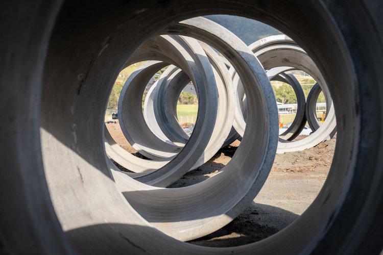
How do Civil Engineers Design Stormwater Systems?
Civil engineers use a variety of tools and techniques to design stormwater systems. The specific process for designing a stormwater system will vary depending on factors such as the location, the intended use of the system, and any unique challenges or constraints. In general, however, the process of designing a stormwater system might involve the following steps:
Conduct a site survey to gather information about the area where the stormwater system will be built, including its topography, geology, and any existing structures or infrastructure.
Develop a plan for the stormwater system, taking into account factors such as the size and layout of the area to be served, the type and intensity of rainfall that the system will need to handle, and any environmental or regulatory constraints.
Use computer modeling and simulations to design the stormwater system in detail, including its specific layout, size, and capacity.
Analyze the design to make sure it meets all relevant safety and performance standards, and to identify any potential problems or issues.
Refine the design as necessary to address any issues or concerns that were identified during the analysis.
Prepare construction drawings and specifications, which will be used by contractors to build the stormwater system.
Oversee the construction process to ensure that the stormwater system is built according to the design and specifications.
Civil engineers use a wide range of tools and techniques to design stormwater systems, including computer-aided design (CAD) software, geographic information systems (GIS), and specialized engineering analysis tools. They also need to be knowledgeable about relevant laws, regulations, and standards, as well as construction methods and materials.
What sort of Engineering Does Pinnacle Surveyors do?
Pinnacle Land Surveyors recognise that each project is different. Also, each client is different and has different abilities and experience. Some clients are very experienced in the construction stage and only require help with the consent process while others would like help throughout the project. Whatever your needs, Pinnacle Land Surveyors can tailor their management services to help you as required.
Pinnacle Land Surveyors can assist with the planning of a new subdivision. Each Council area will have different requirements for subdivision. We are industry experts with contacts in local Councils and a relationship with Private Certifiers across the greater Sydney area. We are able to provide specialist advice to guide you through the often complex process and ensure your proposed subdivision is compliant with relevant provisions.
Works as Executed Surveys are used to ensure the completed or as-built works comply with the approved design plans. They compare the position and levels of roads, footpaths, staircases, detention tanks, sewer, stormwater and other infrastructure. Works as Executed Surveys are required by Council before they will issue an Occupation Certificate to the property owners. These surveys can only be prepared by a Registered Surveyor at the completion of the works on site.
An 88B Instrument is a legal document that accompanies any new plan for registration at NSW Land Registry Services. Pinnacle Land Surveyors have significant experience with drafting Section 88B Instruments to ensure the registration process is expedited and stress-free for our clients. The 88B Instrument sets out any easements, restrictive covenants, positive covenants and rights of way affecting the land, building and/or units within the building and the property to be constructed.
Pinnacle Land Surveyors are able to provide design assistance on civil engineering projects, environmental engineering projects and structural designs based on current Australian Standards. We have a value engineering approach through to the site: recognising the builder’s construction preferences, supporting the architectural vision and ensuring that structural integrity is maintained.
Pinnacle Land Surveyors have extensive experience in town planning matters and ongoing relationships with trusted specialty consultants. We can assist with Development Applications and Modifications, Statements of Environmental Effects, Lodgment and Management of Applications with Council.
We have extensive experience in all types of work from small, residential surveys to complex, large-scale commercial projects and we specialise in small to medium residential subdivision projects (2 – 650 lots)