Drone surveying, also known as aerial surveying, involves the use of uncrewed aerial vehicles (UAVs) equipped with cameras and sensors to capture high-resolution images and data from the air. This technology allows for creating detailed maps, models, and visual representations of the surveyed area. Photogrammetry is the core technology used in drone surveying, which involves measuring distances using photographs. Drones can also be equipped with LiDAR sensors, which use laser pulses to measure distances and create accurate 3D terrain models.
Benefits of Drone Surveying
Drone surveying revolutionises how geographic data is collected, processed, and analysed by offering a faster, safer, and more cost-effective alternative to traditional surveying methods or in combination with those methods.
At Pinnacle, we merge together drone data with various surveying workflows to provide the most optimal solution for each project.
These are high-resolution aerial images that have been geometrically corrected to be used as maps within CAD and GIS software. Orthomosaic maps are essential for visualising large areas and are widely used in urban planning, agriculture, and environmental monitoring.
DEMs represent the bare earth's surface, excluding trees, buildings, and other objects. They are crucial for topographic analysis, flood modeling, and land development projects.
Unlike DEMs, DSMs include all objects on the earth's surface. They are used in urban planning, telecommunications for line-of-sight analysis, and construction projects.
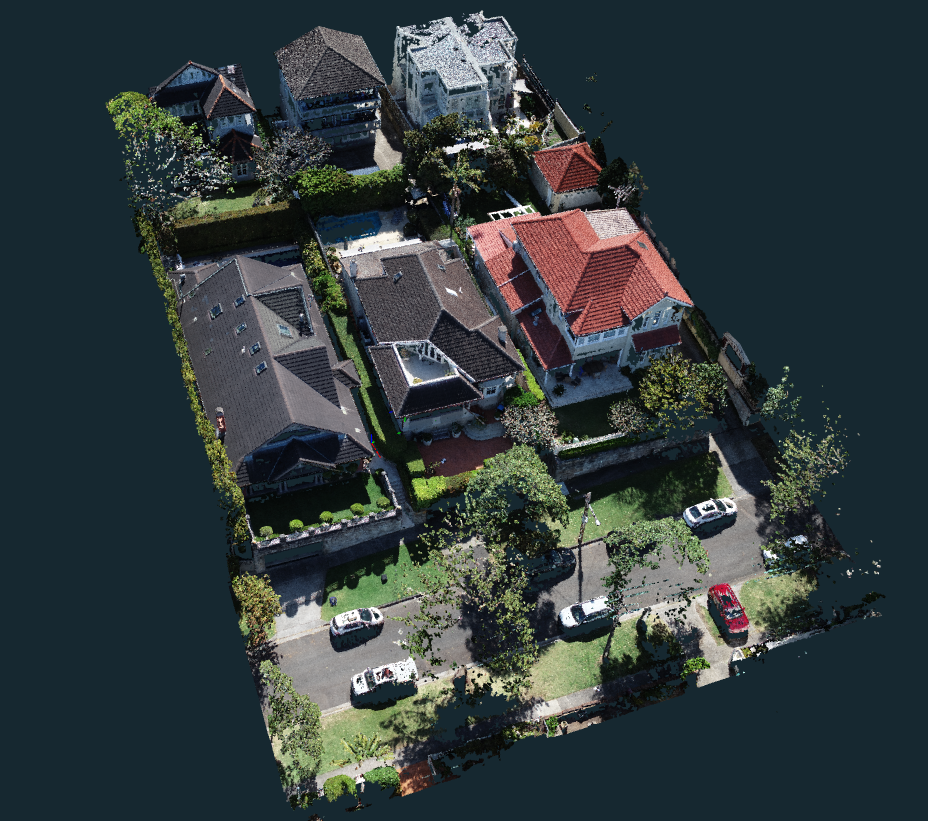
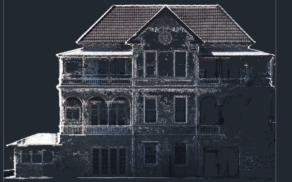
Drones can create detailed 3D models of terrain and structures by capturing images from multiple angles. These models are used in architecture, construction planning, and heritage conservation.
LiDAR technology uses laser pulses to create highly accurate 3D representations of the surveyed area. These point clouds are valuable in forestry management, mining, and infrastructure inspection.
Drones can accurately measure the volume of stockpiles or excavation sites. This is particularly useful in mining, construction, and resource management for inventory tracking and project planning.
We provide a range of drone services for mapping, design, stockpile surveying and 3D modelling. Contact us today to find out more about how drone technology can enhance your project.
We have extensive experience in all types of work from small, residential surveys to complex, large-scale commercial projects and we specialise in small to medium residential subdivision projects (2-650 lots)